Climate change, natural disasters, humanitarian crises – today’s challenges require quick access to information about what’s happening on the ground. A new European system will use satellite and terrestrial data to help the human response. Keeping an eye on Earth.
Climate change, natural disasters, humanitarian crises – the challenges of today’s world require quick access to information on what’s happening on the ground.
We need to constantly monitor the evolution of the global environment, while being able to quickly focus on the local regions when the need arises.
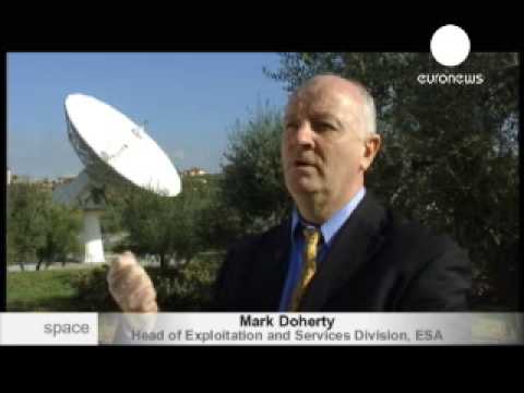
Mark Doherty / Responsible for GMES services, ESA: ”We’re here, at ESA’s Earth Observation center, in ESRIN, Frascatti, Italy. And this antenna is capturing data from data relay satellite, and it is bouncing the data from the ENVISAT satellite, which is orbiting the Earth 14 times a day.”
At the European centre for Earth observation the data from satellites around the planet is being constantly received, analysed, archived and distributed around the world.
Mark Doherty: “There is a broad spectrum of services. That’s an important thing to understand about satellites that monitor the Earth: they’re very flexible. The types of services they provided range from monitoring sea ice extent in the Baltic sea to gauge shipping and reduce fuel use by the ice-breakers that are opening the routes. To monitoring the extent of tropical forests, and assessing deforestation rates to protect those forests.”
Another threat to forests and woodlands are wildfires: every year firestorms spread through European forests, leaving vast burned areas.
Satellite pictures allow authorities to visualise the scale of disaster and provide the adequate assistance. The catastrophic 2007 forest fires in Greece are a good example.
Balatsos Panagiotis / Forest engineer, Greek ministry of rural development and food: ”In this kind of situations we need rapid assessment of the damages to react and to help decision makers to rehabilitate all the damages and to plan how to work fast.”
When a series of massive forest fires broke out in several areas of Greece, killing 84 residents and firefighters, Greek authorities requested European help. This came in the form of high-resolution satellite images of about 3000 square kilometers of burned-out land.
Balatsos Panagiotis: “This resolution was delivered for the first time for us, free of charge, (and helped many of our) services to deal with the extreme situations that we were facing. For this we thank this program, because otherwise we would had to have airplanes to photograph the situation to assess.”
Both in case of emergencies and for everyday environmental observations, satellite pictures are obviously helpful. But currently Europe doesn’t have enough satellites to ensure constant monitoring of how our planet is changing.
The next goal of European scientists and politicians is the full-scale, continuous Global Monitoring for the Environment and Security: GMES, also known as Kopernikus – a planet-wide system providing openly-accessible data from space satellites and sensors installed on the ground, floating in the water or flying through the air.
Mark Doherty / Responsible for GMES services, ESA: ”If you look at the case of disasters it means that you have to have an organisation there 24 hours a day, 365 days in a year capable of answering a phone when the call comes from anywhere in the world, capable of tasking the satellites immediately to acquire the data over, for example, the disaster area, capable of acquiring the data, processing it, analyzing it, extracting the important information and capable of delivering it to the people who need it in the field, quickly.”
Such a system may be up and running in the next few years, when new satellites will have replaced their predecessors orbiting the Earth today. Both optical and radar observation devices are needed to ensure a complete picture in any weather conditions, any time of day.
ITW Josef Aschbacher: ”If you have flooding, it’s cloud covered, because it rains, and therefore it’s cloudy. So normally satellites in the optical domain can’t look through clouds. So what you need is radar satellites. Radar, as well-known, can go through the clouds, even through rain layers, and you can get information independent of cloud coverage and independent of sunlight. So even at night you get information. So you take this information, which is all-weather, day and night information, through the clouds, and you can assess the situation immediately once the satellite fly’s over.”
Initially developed as a scientific project ten years ago, GMES is now evolving into a fully mature operational service system, thanks to international funding and research. The European Union is covering the costs and taking responsibility for managing the future services.
Mark Doherty: ”What Global Monitoring for Environment and Security is all about is making a huge quantum leap, taking examples of projects that have been carried out with many interested users, but on a demonstration basis, and making big step to provide those services on an operational basis. It’s very similar to what was done 25 years ago for meteorology.”
The scale of the project is truly global: with GMES it would be possible to observe and even predict a full spectrum of various environmental indicators. People will be able to get accurate and complete forecasts of chemical composition of the atmosphere several days in advance – in the same way that today they get accurate temperature and wind conditions reports.
Josef Aschbacher / Head of the GMES Space Office, ESA: “In ten years from now you will have a much better access to information through GMES: you will have a combination of observations from satellites, combined with other measurements taken in the air, at the ocean and at land. Combining this information with forecast models, with predictions, we’ll be able to know the state of environment pretty well.”
Five types of satellites are being developed specifically for the GMES program. Called “Sentinels”, they will fill the gaps in the next few years, providing continuous radar data, visual detection of emergencies, land and ocean monitoring as well as enhanced meteorological services for everybody’s use.
Mark Doherty: ”For regular citizens – hopefully they won’t notice it, in the same way that they don’t notice it when we launch a new meteorological satellite. They should have better services, better security, they should have their national, local and regional organisations that take care of the environment for them, should have better data to let them make better decisions more promptly, better informed, on behalf of those citizens. So GMES should and will contribute to the increase in the quality of life for citizens, but hopefully they won’t notice it – they’ll just see life improving and they’ll be more secure.”
Better management of our natural resources, cleaner water and air, more efficient urban planning – GMES has the potential to improve our lives and those of future generations by keeping an eye on the changing world around us.


